Tuesday, January 04, 2011

Australia Floods [PICTURES]


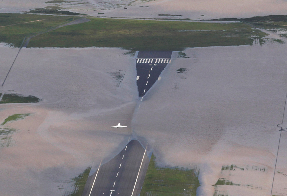
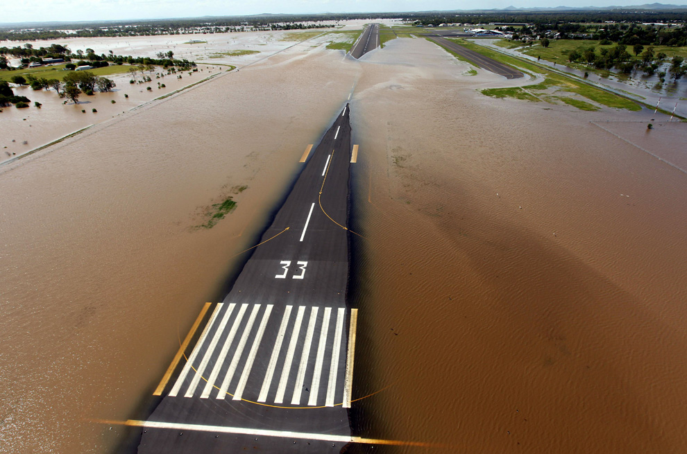
Rising floodwaters spread across the runway of the airport at Rockhampton, in eastern Queensland, Australia on January 2, 2011. (MECHIELSEN LYNDON/AFP/Getty Images) #

A snake crosses the Capricorn Highway which is under floodwaters 6km south of Rockhampton, Australia on January 3, 2011. (REUTERS/Daniel Munoz) #

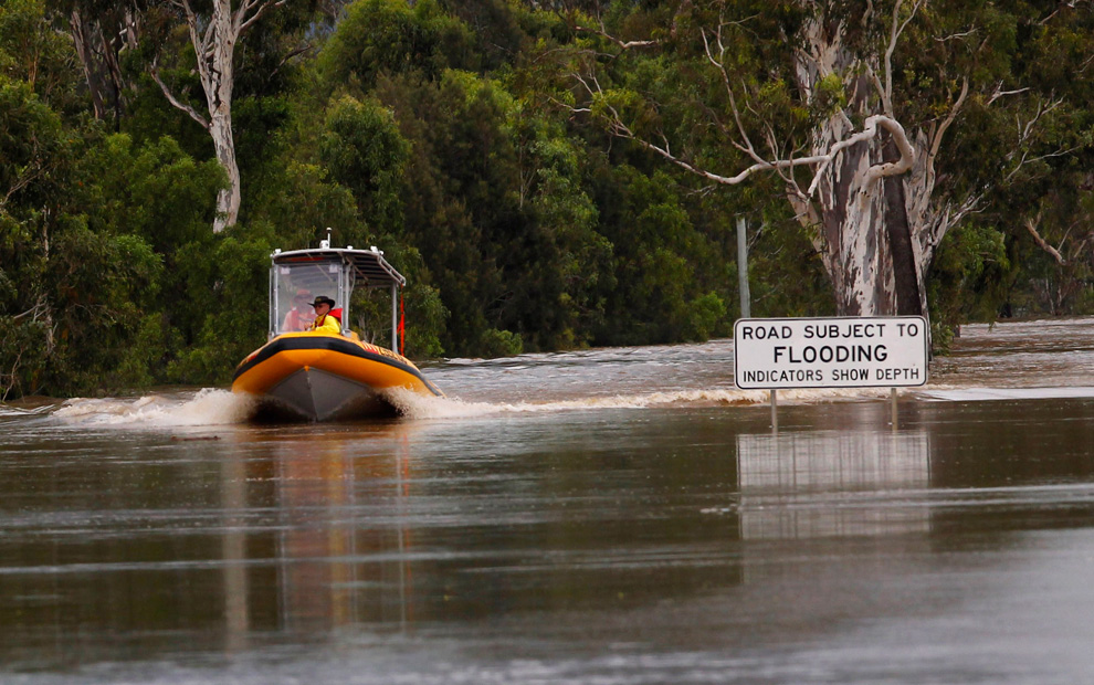
An emergency personnel boat motors past a street sign partially covered by floodwaters 6km south of Rockhampton on January 3, 2011. (REUTERS/Daniel Munoz) #

Houses in the town of Theodore, about 410km (255 miles) north west of Brisbane, Australia, are partially submerged by flood waters in this January 1, 2011 picture. (REUTERS/Queensland Police Service) #

Cattle walk through flooded crops near the town of Theodore in Australia's state of Queensland January 2, 2011. Large parts of Australia's coastal northeast were flooded on Sunday in a spreading environmental disaster as thousands of residents fled their homes to avoid the runoff from a Christmas deluge. (REUTERS/Daniel Munoz (AUSTRALIA - Tags: DISASTER ENVIRONMENT ANIMALS) #
A main street in the flooded town of Theodore, Australia is used as a helicopter landing zone as residents are evacuated in this January 1, 2011 picture. (REUTERS/Queensland Police Service) #

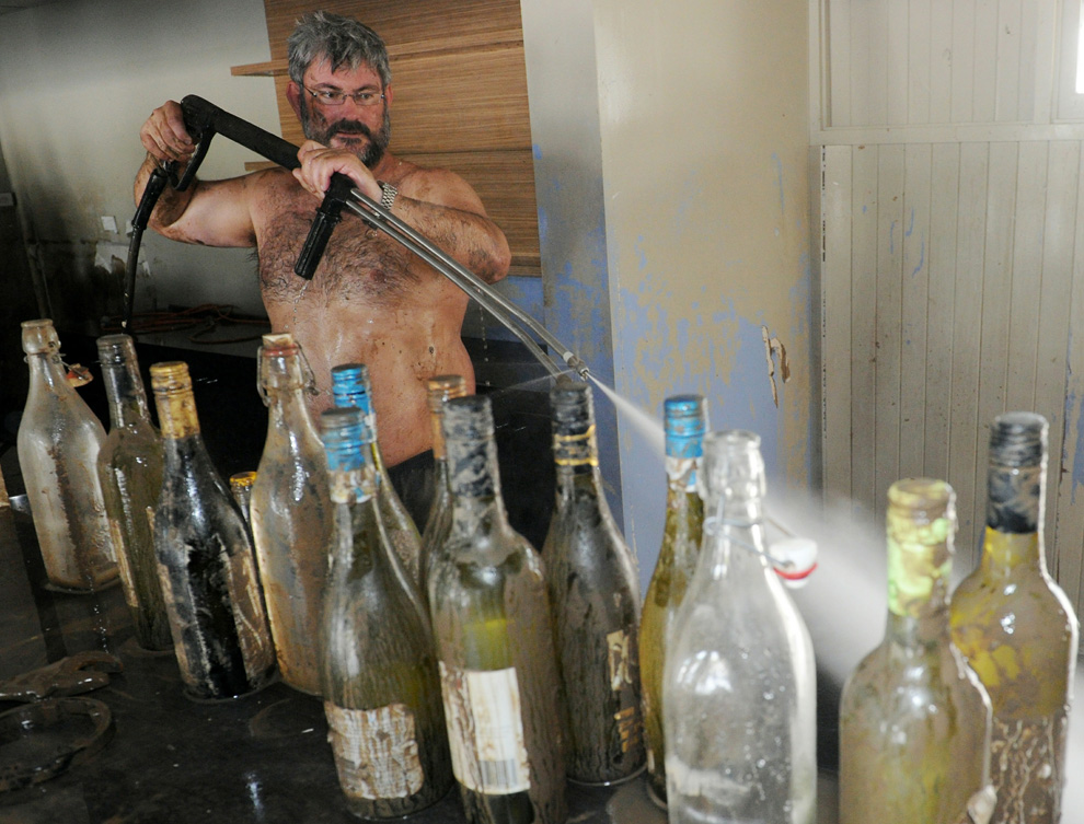
Bruce Dalton cleans mud from the recently submerged Spinnakers bar and restaurant on the banks of the swollen Burnett River in Bundaberg as flood waters begin to recede on January 1, 2011. (TORSTEN BLACKWOOD/AFP/Getty Images) #

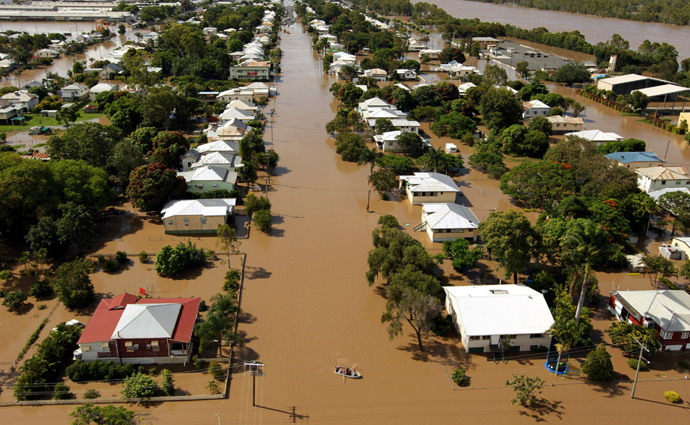
Rising floodwaters spread through the low-lying suburb of Depot Hill in Rockhampton, in eastern Queensland on January 2, 2011. (MECHIELSEN LYNDON/AFP/Getty Images) #

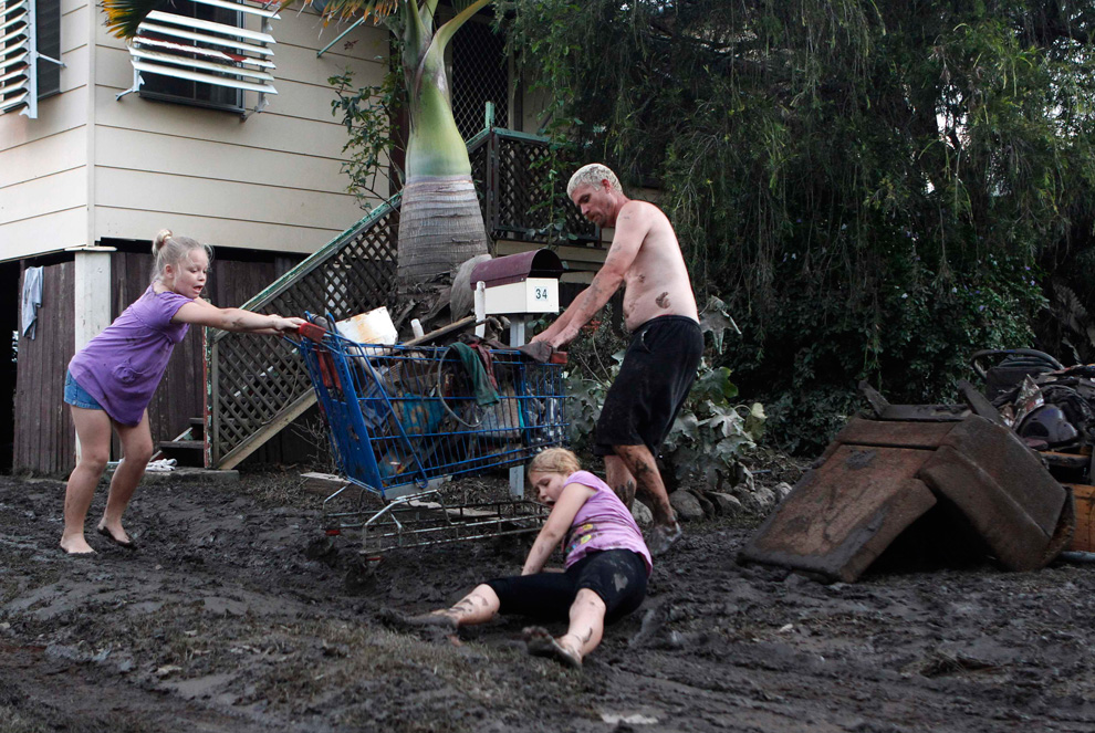
A girl falls in the mud as her sister and father remove damaged belongings from their home affected by floodwater in Bundaberg, Queensland January 1, 2011. (REUTERS/Daniel Munoz) #

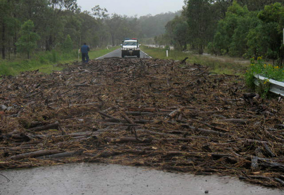
A police vehicle is halted by flood debris across a road near the town of Injune, about 480kms (298 miles) northwest of Brisbane on January 1, 2011. Floods that have inundated 22 Australian towns and forced more than 200,000 from their homes headed towards the northeast coast on New Year's Day, forcing further evacuations and warnings of 30-ft flood waters. (REUTERS/Queensland Police Service) #
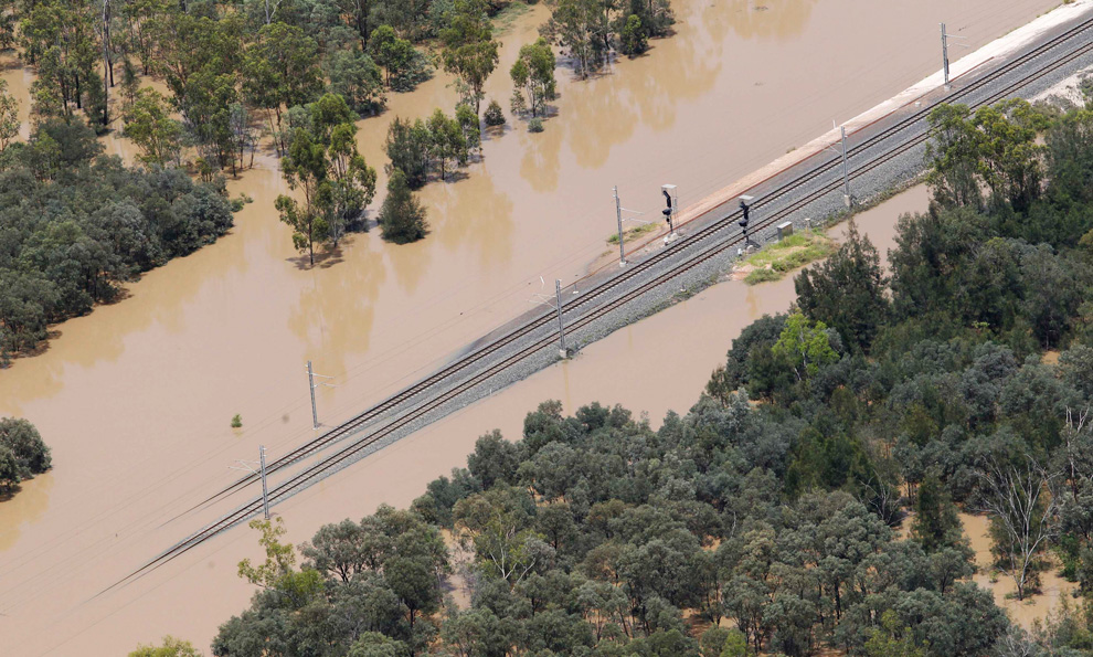
Partially submerged railways to transport coal are seen near the town of Emerald in Australia's state of Queensland January 2, 2011. Large parts of Australia's coastal northeast were flooded on Sunday in a spreading environmental disaster as thousands of residents fled their homes to avoid the runoff from a Christmas deluge. (REUTERS/Daniel Munoz) #
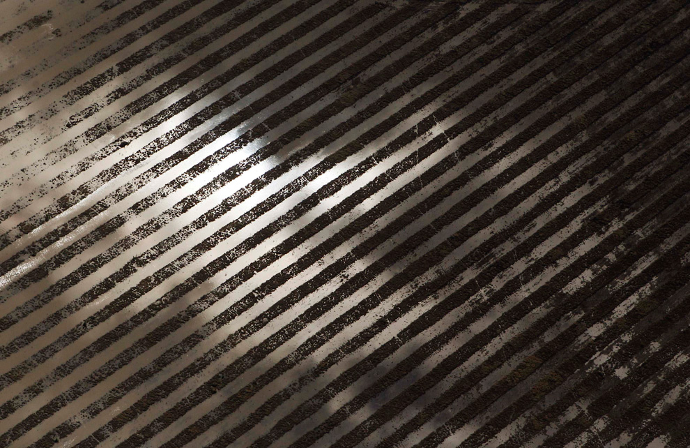
Workers of a hardware store start to clean up after being affected by flood waters in Bundaberg, Queensland, Australia on January 1, 2011. (REUTERS/Daniel Munoz) #

Farm crops are seen flooded near the town of Theodore in Queensland, Australia January 2, 2011. Large parts of Australia's coastal northeast were flooded on Sunday in a spreading environmental disaster as thousands of residents fled their homes to avoid the runoff from a Christmas deluge. (REUTERS/Daniel Munoz) #

A small plane takes off from a portion of the flooded runway at the Rockhampton airport in the state of Queensland January 2, 2011. (REUTERS/Daniel Munoz) #

A coal ship waits to be loaded at the port in Gladstone, Queensland January 2, 2011. Torrential rains and flooding are set to cut rail supplies of coal for another week from inland mines to Australia's third-largest coal export terminal Gladstone, forcing the port to run down already-depleted inventories. (REUTERS/Daniel Munoz) #
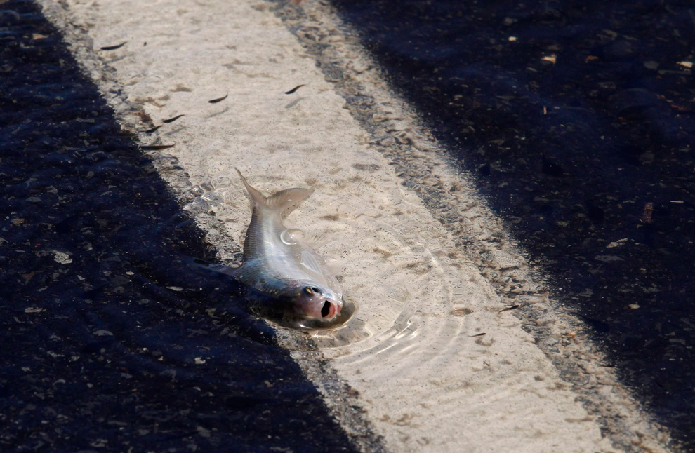
A fish is seen on the Capricorn Highway, which is partially submerged under floodwaters, 6 km (3.7 miles) south of Rockhampton, January 3, 2011. Military aircraft flew supplies to an Australian town slowly disappearing beneath floodwaters on Monday, as record flooding in the country's northeast continues to cut coal exports and devastate wheat production. (REUTERS/Daniel Munoz) #
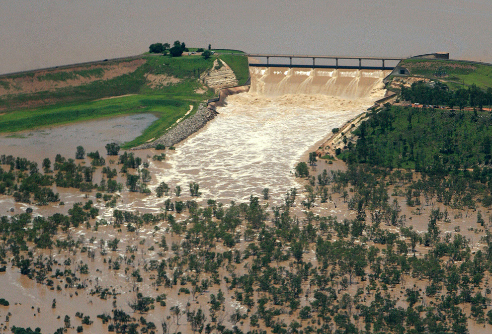
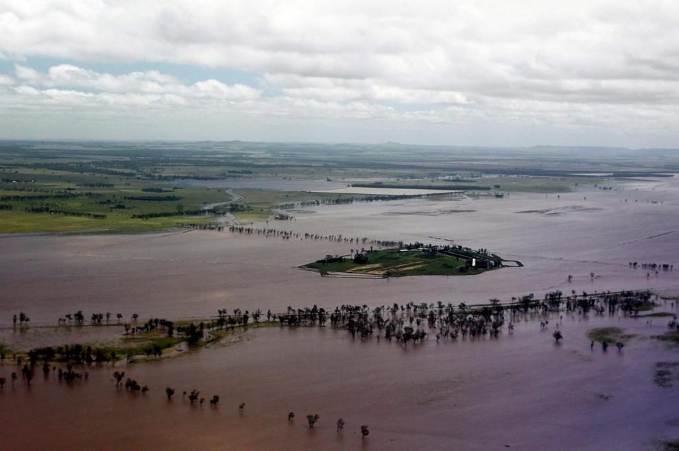
This aerial photo taken on December 31, 2010 shows the Fairbairn Dam spilling into the Queensland town of Emerald, illustrating the extent of flooding across the area. (JONO SEARLE/AFP/Getty Images) #

Agricultural machinery is seen on an isolated island surrounded by flood waters near the town of Emerald in Australia's state of Queensland January 2, 2011. (REUTERS/Daniel Munoz) #

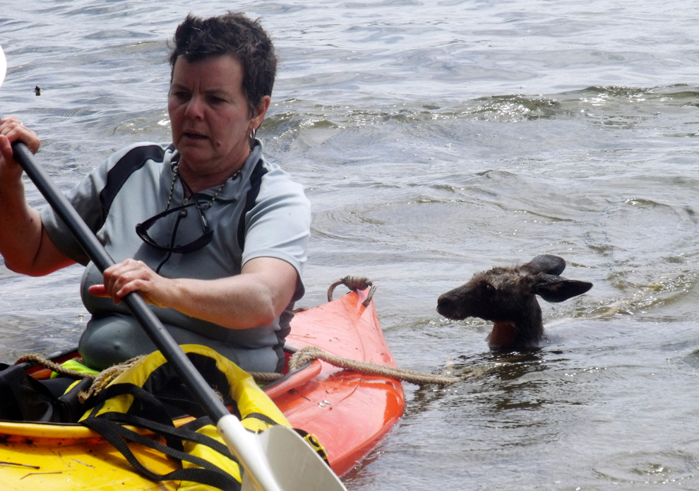
Ann Mara uses a kayak and a rope to tow a kangaroo through floodwaters near Wellington, Australia. Thousands of people have been forced to evacuate their homes, and officials have been scrambling to pluck stranded motorists from cars and surround vulnerable homes and businesses with sandbags as Australia's attorney general declared 45 communities along the country's east coast disaster areas Friday, Dec. 10, 2010, following weeks of drenching rains. (AP Photo/Lake Burrendong Sport and Recreation Centre, Tracy Woods) #
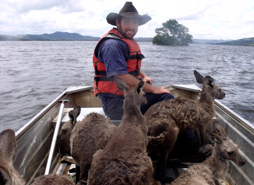
Rodney Dowton ferries a boatload of kangaroos through floodwaters near Wellington, Australia. (AP Photo/Lake Burrendong Sport and Recreation Centre, Tracy Woods) #

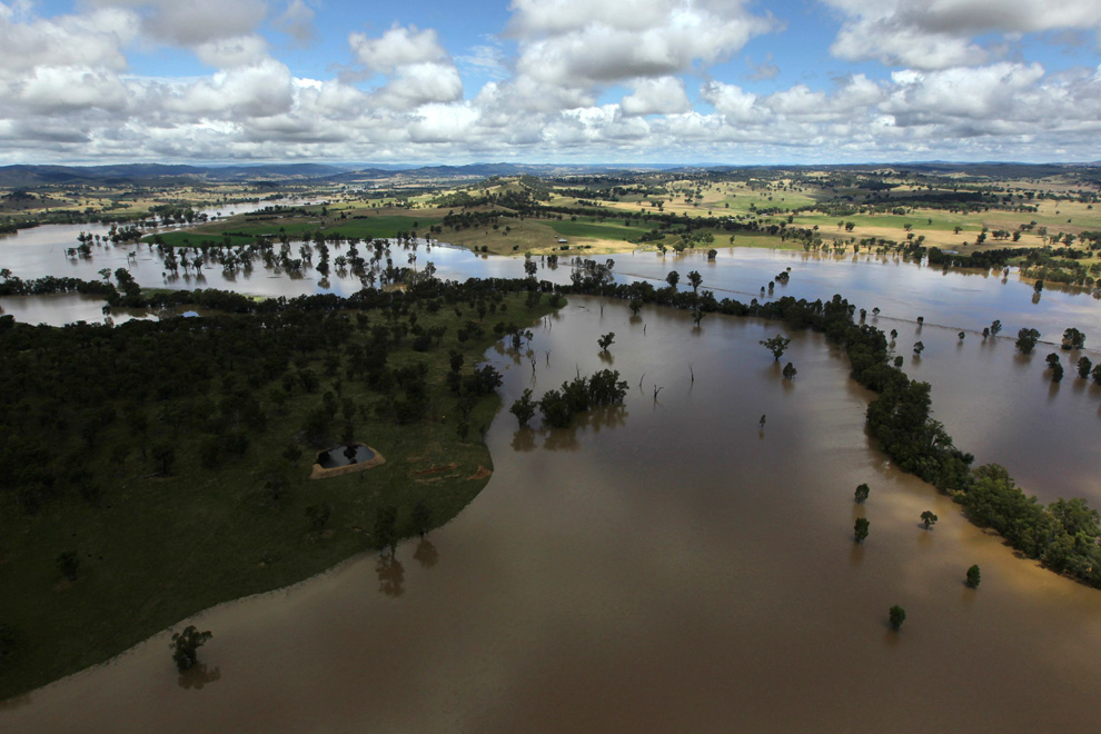
A swollen river is seen near the town of Tumut, 400 km (250 miles) south-west of Sydney, December 9, 2010. Torrential rain is wreaking more havoc across eastern Australia, with flash floods continuing to cause problems for residents, according to local media. (REUTERS/Wolter Peters) #

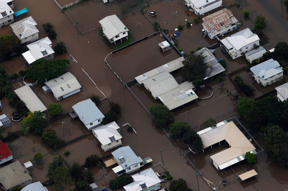
Buildings are submerged in floodwaters in a neighborhood in Rockhampton, Queensland on January 2, 2011. Large parts of Australia's coastal northeast were flooded on Sunday in a spreading environmental disaster as thousands of residents fled their homes to avoid the runoff from a Christmas deluge. (REUTERS/Daniel Munoz) #
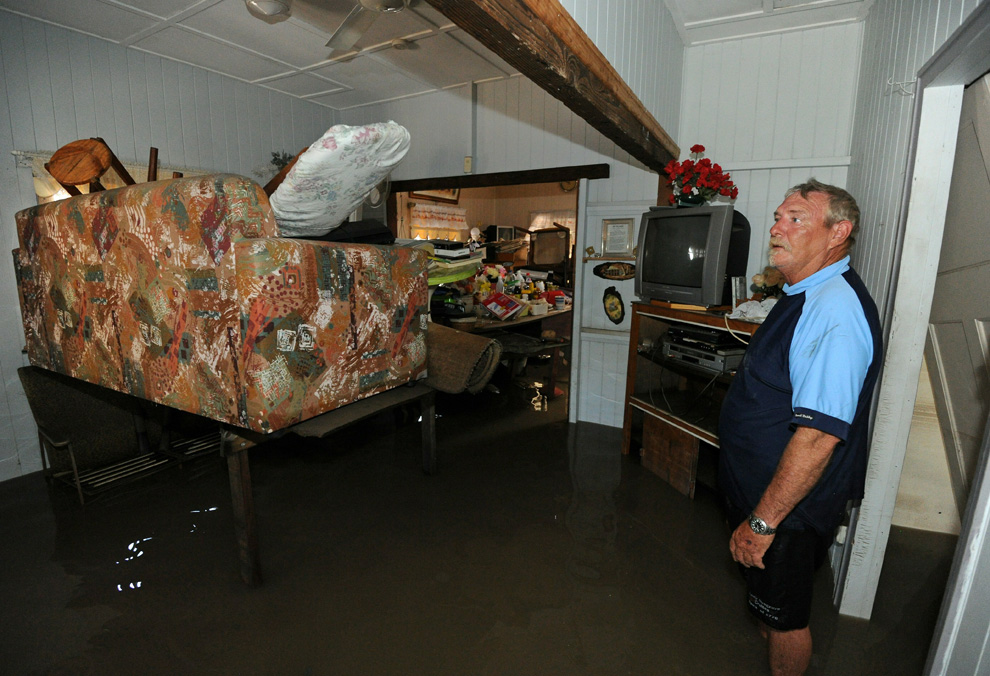
Christopher Roth tries to salvage what he can from his parents' flooded home in Bundaberg on December 31, 2010. (TORSTEN BLACKWOOD/AFP/Getty Images) #

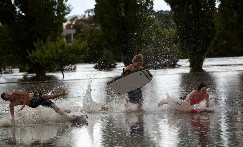
Local teenagers make the best of ther conditions after heavy rainfall hit the the capital region on December 9, 2010 in Queanbeyan, Australia. (Andrew Taylor/Getty Images) #

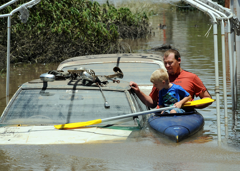
Scott Wogandt and his son Mitchell kayak past flooded cars in Bundaberg on December 31, 2010. (TORSTEN BLACKWOOD/AFP/Getty Images) #

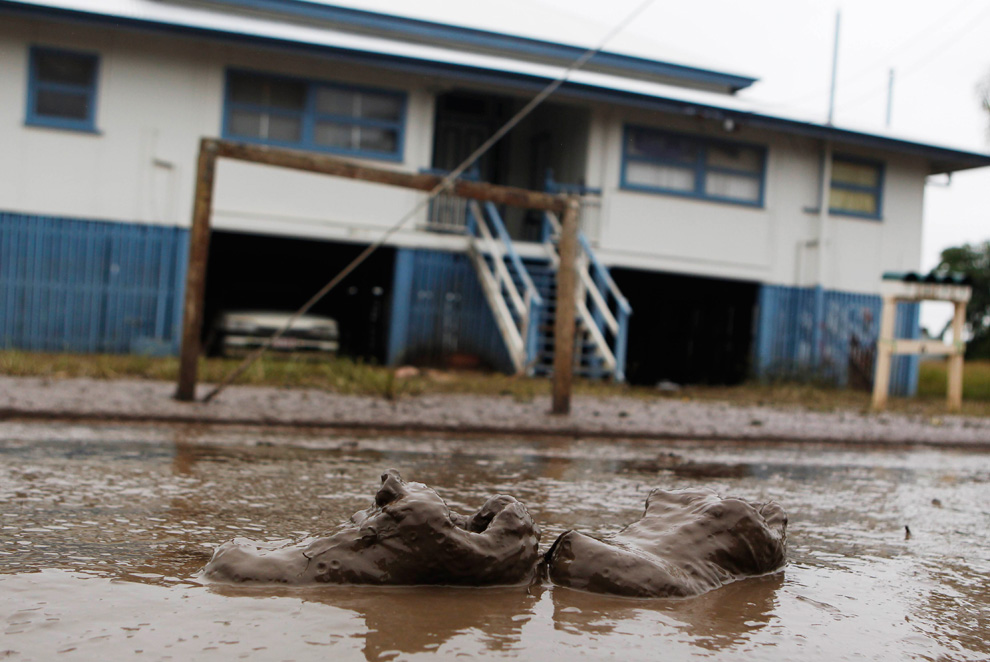
A pair of shoes lie in the mud after flooded waters start to receded in Bundaberg, Queensland, Australia January 1, 2011. Flood water rose across Australia's northeast on Friday, covering an area bigger than France and Germany combined, inundating 22 towns and stranding 200,000 people, and closing one of the country's major sugar export ports. (REUTERS/Daniel Munoz) #
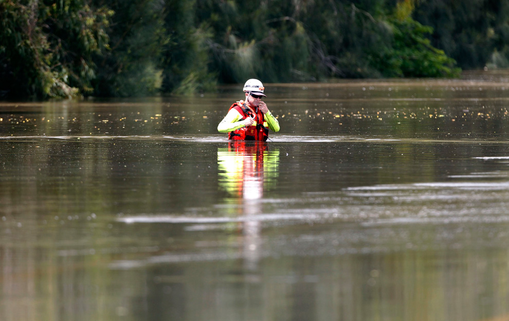
A worker from emergency services walks through the Capricorn Highway, which is submerged in floodwaters, 6 km (3.7 miles) south of Rockhampton, January 3, 2011. (REUTERS/Daniel Munoz) #

Flood waters cover the land near Warwick, Queensland on December 28, 2010 as entire towns were inundated by the worst deluges in decades. Torrential rains following in the wake of tropical cyclone Tasha have swollen rivers and flooded scores of farms and homes in the northeastern state of Queensland. (JEFF CAMDEN/AFP/Getty Images) #
A half-drowned brush-tail possum seeks shelter in an up-turned caravan on the banks of the swollen Burnett River in Bundaberg as flood waters begin to recede on January 1, 2011. (TORSTEN BLACKWOOD/AFP/Getty Images) #

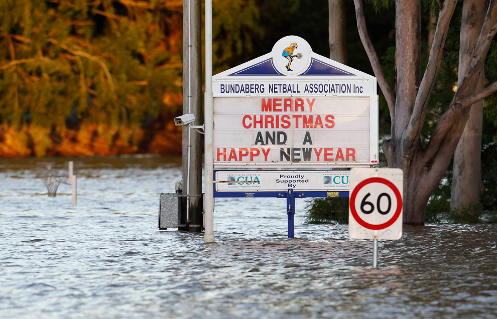
Signboards are partially submerged by floodwater in Bundaberg, Queensland December 31, 2010. (REUTERS/Daniel Munoz) #

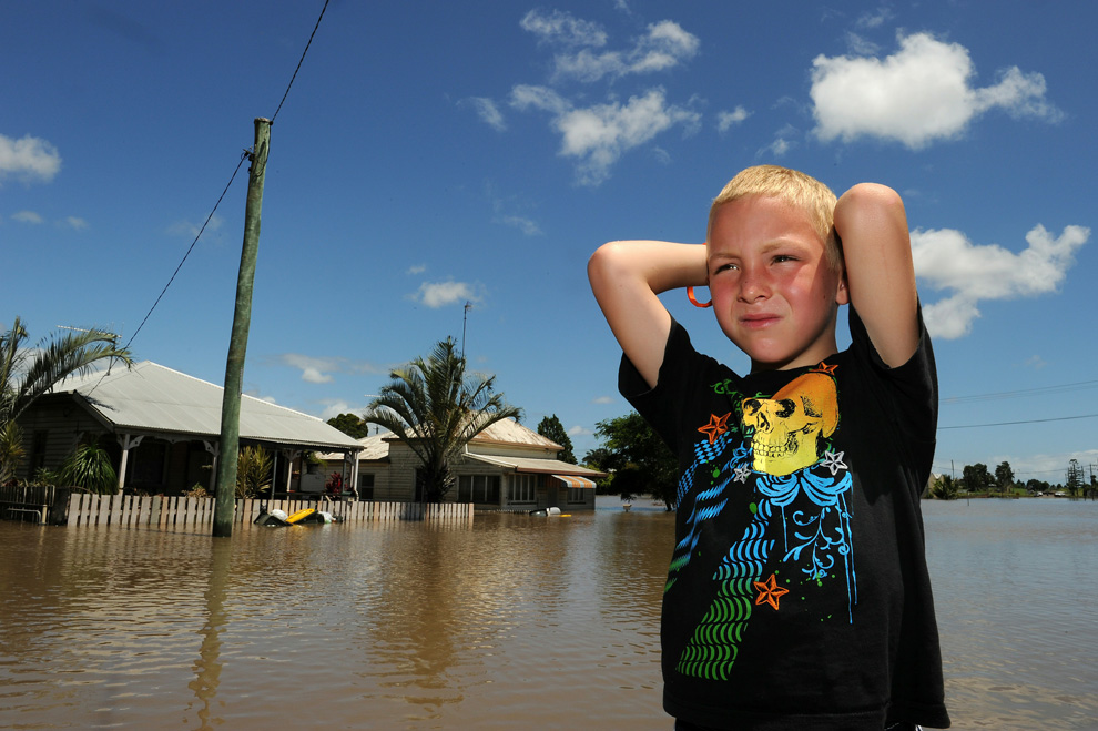
Six-year-old Jake Thompson looks at flood waters that have engulfed Alexander Street in Bundaberg on December 31, 2010. (TORSTEN BLACKWOOD/AFP/Getty Images) #
No comments: